How GoodRoads Automates PASER Pavement Assessments
The Problem: Manual PASER ratings are slow, subjective, and don't scale. A crew rating 20–30 miles a day means a mid-sized city takes months to survey — and two engineers on the same street can easily differ by 2 points on a 10-point scale. In states like Wisconsin, that require an updated PASER rating every 2 years, the timeline can get very tight!
What GoodRoads Does: Our Roadie device mounts to any vehicle and collects continuous imagery as a driver covers the road network at normal speed. Our AI pipeline then analyzes each segment for road type and specific distresses — alligator cracking, rutting, potholes, raveling — and generates a PASER score (1–10) for every road, backed by GPS-tagged photos.
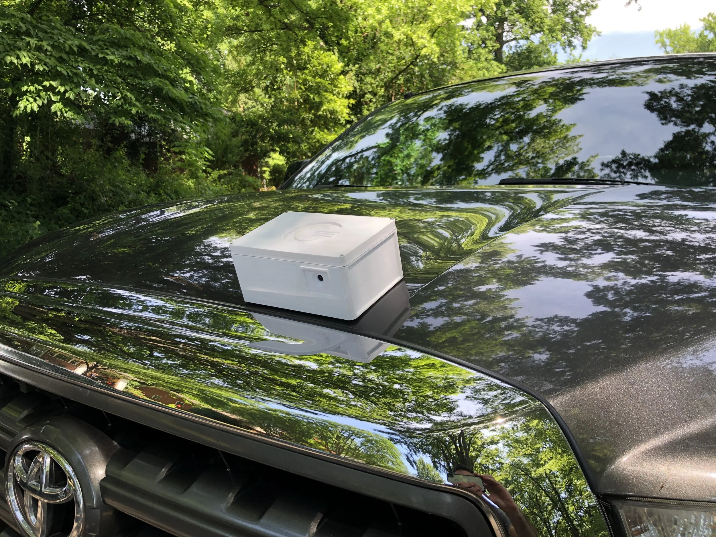
Up-close view of a mounted GoodRoads inspection unit (“Roadie”)
What You Get: An interactive map of PASER scores, a prioritized treatment list, and a multi-year budget forecast. A full city network in days, not months.
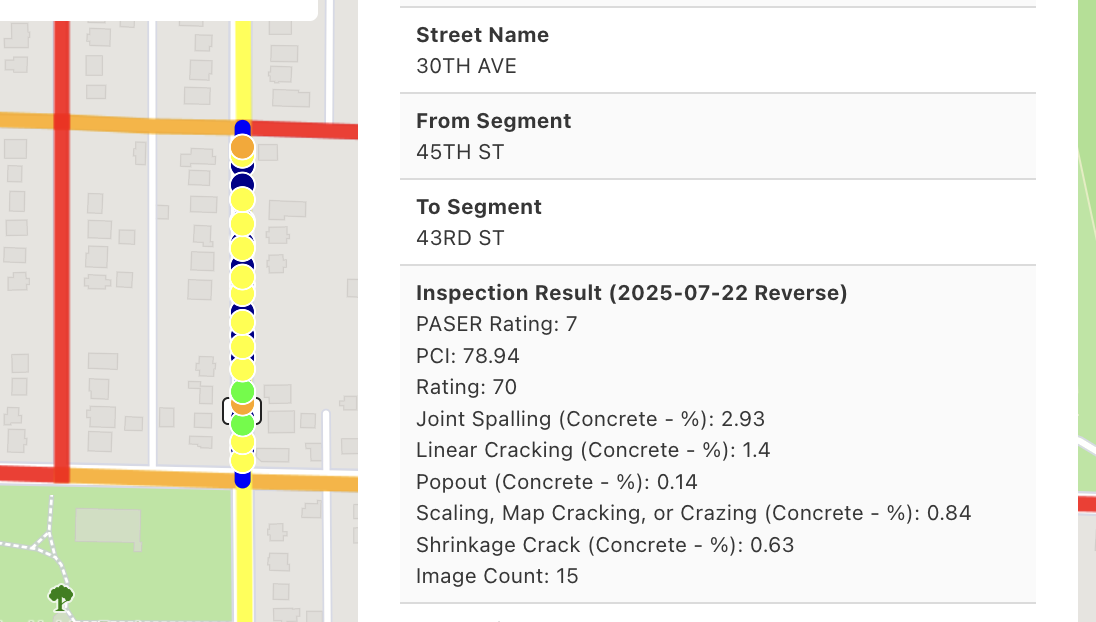
Sample result of a concrete road inspected according to PASER
Not doing PASER in your jurisdiction, but PCI (ASTM D6533) instead? No problem, we do that too!
If your city is still relying on manual windshield surveys for PASER ratings, there's a faster, more consistent way to get it done. Reach out to the team at GoodRoads — let's put your roads on the map.